


In the digital age, interactive maps and online tools have transformed the way we learn about the world. Whether you’re a student researching a school project, a parent helping your child with geography homework, or simply someone curious about other cultures and places, online mapping resources provide a fun and engaging way to explore.
What Are Interactive Maps?
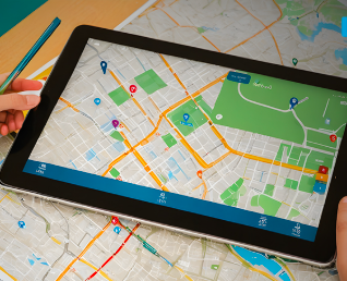
Interactive maps are web-based tools that let users explore locations and data through clickable features. Unlike traditional paper maps, these digital versions often allow zooming, toggling between layers (like terrain or satellite view), and accessing real-time information such as weather or traffic updates.
Examples include:
Google Maps for directions, street views, and exploring landmarks.
National Geographic’s MapMaker for educational layers on population, land use, or climate.
Mapbox and OpenStreetMap for customizable and community-contributed mapping content.
Educational Benefits of Interactive Tools
These platforms do more than just show you where something is—they help you understand why places matter and how different factors like climate, elevation, or history shape our environments. For educators and learners, they offer:
Visual learning opportunities.
Hands-on exploration of geography, demographics, and culture.
Enhanced digital literacy, a crucial 21st-century skill.
Many classrooms now use digital tools to bring lessons to life. Students can measure distances between cities, compare weather patterns, or even simulate natural disasters to see how geography affects communities.
Creative Ways to Use Maps at Home
Using these tools isn’t just for schools. Here are a few engaging ways to use interactive maps at home:
Plan a virtual family road trip and mark fun destinations.
Track animal migration patterns or weather events together.
Create your own story map for a recent vacation or historical journey.
Safety and Accessibility
The best part? Most interactive mapping tools are free and safe to use. Platforms like Google Earth or ESRI’s Story Maps provide secure, family-friendly access to a wealth of visual data. It’s important to remind children never to share personal details while exploring online and always use trusted sources.
Encouraging Exploration Through Technology
By turning learning into a hands-on adventure, interactive maps promote curiosity and global awareness. Whether it’s locating volcanoes, tracing ancient trade routes, or studying modern cities, these tools open doors to a world of discovery.
Conclusion
Interactive maps and online tools offer more than just convenience—they unlock opportunities for education, creativity, and connection. As technology continues to evolve, so do the ways we learn about our world. With a little curiosity and the right tools, every click becomes a journey.
